Chepstow Roman Crossing
The Day School on the Roman Crossing of the Wye, held on the 19th October 2024, was a tremendous success. Over 160 enthusiastic attendees packed the Chepstow Drill Hall throughout the afternoon for presentations and discussion.
John Burrows opened with a thorough analysis of the engineering and military challenges of building the crossing, to explain why it was where it was, and why later crossings were located differently.
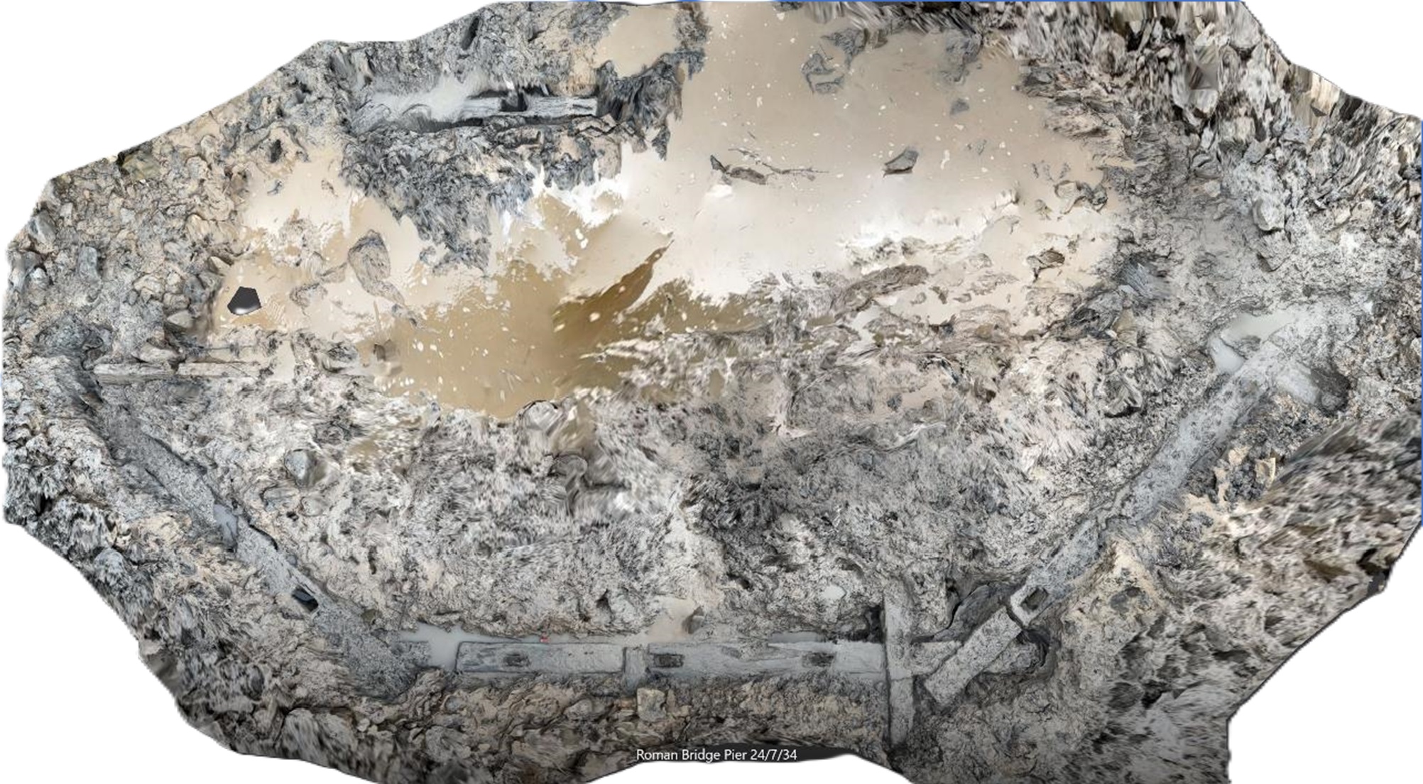
Simon Maddison then described the history and investigations of the spectacular timber bridge pier, 12m x 6m, constructed of substantial oak beams. This is located near the low tide mark, limiting access to under 2 hours, even at springs. There are timber piles on the English side, investigated in 2003. Simon concluded with some ideas as to how the bridge might have looked.
Professor Nigel Nayling summarised the scientific dating of these timbers, setting them clearly in the Roman era, 1st Century AD, similar to the piles dated in 2003 from the English side.
Lynne Davies rounded off the first session with a detailed description of the approaches to the site on both sides of the river, including CAS excavations on the 400m long, 7m wide engineered trackway that runs down to the bridge site from the School, at a slope of 1:10. Further excavations are planned this winter to try and find datable material and establish what relationship it might have had with the Piercefield Walks. Lynne also showed the work done by Extreme Archaeology on the agger in the meadow on the English side in 2003.
Professor Mark Horton showed the drone surveys that he had made of the site and speculated as to the route of the access road to the north towards Gloucester. According to Mark, there is no sign of the road continuing beyond Newnham, where it turns to a known crossing of the Severn, joining with the via Julia through Alringham on the other side. Boldly he speculated as to whether there might have been a Roman bridge across the Severn at this point!
Dr Mark Lewis then dug deep into the evidence of Roman itineraries, mapping, tithe, LiDAR and other inscription data to identify the likely route of the roadway from the bridge to Caerwent, all in the context of crossing the Severn and how that might have worked. He further described the accumulating evidence of Roman material from within Chepstow, and the speculations over possible Roman settlement and fortifications there, as well as the possible form of the bridge by comparisons with other Roman bridges, and the old bridges in Chepstow itself.
Finally, Dr Toby Driver presented the fast-growing evidence of Roman military and settlement activity all over Wales, established from the swelling corpus of aerial photography that he is responsible for. In particular, the more detailed site evidence that is emerging for the progress of the military invasion of south Wales, with more exciting candidates emerging for field investigation.
The afternoon wrapped up with a lively open discussion between the presenters and the audience, with many probing questions and speculations as to further work and interpretation of the evidence that has been gathered. As ever, more questions than answers were raised, but unquestionably, the work going on is of national importance and steps as to how it might be further progressed were tentatively formed.
Many thanks to all the speakers for an excellent and informative afternoon, and to the audience for their interest and enthusiasm! PDFs of the presentations are available below.